LOGitEASY's web-based soil logging and boring log software (LOGitEASY eForm) is usable both in the field and in the office for transferring field notes. Once the data is entered into the software, logs can be produced in a variety of templates, incl...
GEO5 is an intuitive software suite providing a solution for the majority of geological & geotechnical tasks. From geological site investigation, subbase model creation up to a wide range of analyses such as slope stability, deep excavation, and...
LogPlot - the standard in log plotting software. LogPlot is an easy-to-use log plotting program with a flexible log layout and intuitive data editor. LogPlot software has been used by geoscientists since 1983 to display their geotechnical, environmen...
Mobile application GEO5 Data Collector (for Android and iOS in May/23) is used for data collection in the field or laboratory and works with mobile phones and tablets. The mobile application and the GEO5 Stratigraphy program can then exchange these d...
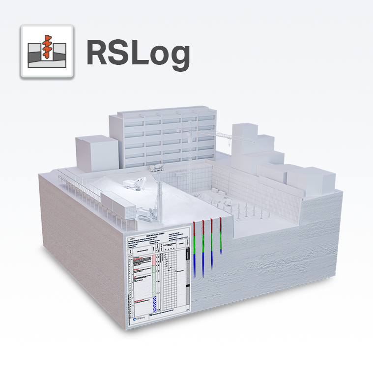
Rocscience suite of programs is RSLog – a cloud-based borehole log management application built to eliminate the manual data entry process. Combined with a template designer, RSLog allows you to easily customize borehole data and match the...
The purpose of site investigation is to compile an appropriate information base about a particular site. Data management embraces the whole range of activities involved in the handling of data gathered. The GeoEnviron Site Survey Manager has been des...
Our intuitive cloud-based borehole logging software removes a well know bottleneck within the Geotechnical Investigation process by generating finished graphical logs, on site, and in seconds. This means no data entry time back in the...
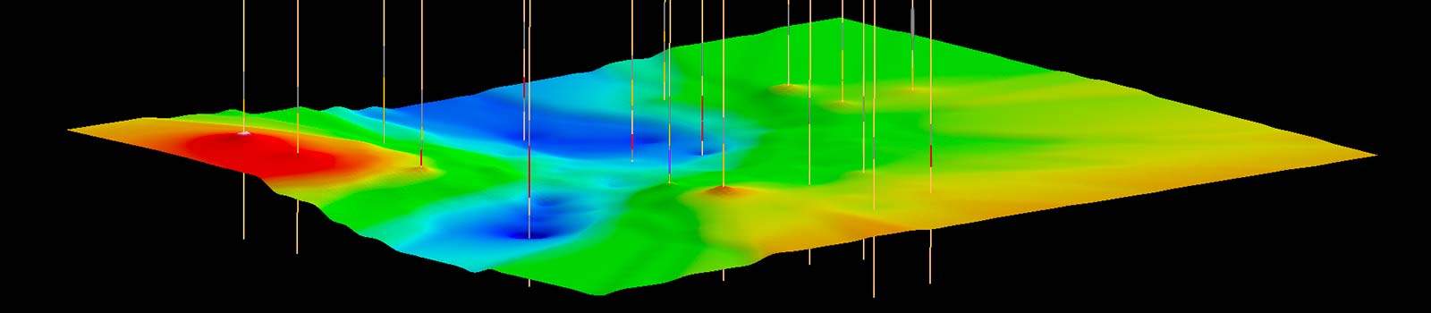
Create and visualize both 2D & 3D geologic models, starting with classification and visualization of borehole logs, creation and editing of cross sections, and generation of 3D geosections and geovolumes.
Vulcan Explorer provides an interactive 3D visualisation and modelling environment to plan drill holes, identify targets and preliminary reserves, and test and validate exploration models. Block models and 3D triangulated surfaces created with Vulcan...
pLog is tablet-based field data collection software. pLog is the industry leader in geotechnical and geo-environmental data collection technology. It is the most advanced application for collecting site investigation and environmental sam...
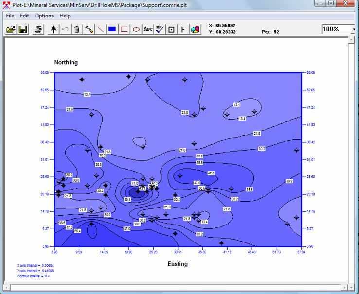
DrillHoleMS is a Windows program for drawing and plotting drill hole/mine cross sections, drill/well logs and plans. A wide variety of options allow the sections, logs and plans to be customized to your requirements. Designed for presenting and...
SeiImager/DH is an interactive processing suite for determining the P and S wave velocities from downhole seismic records. Features: Analyze P-wave and S-wave downhole seismic data acquired with a variety of sensors (downhole hydrophone arra...
DartisLog is a bore log software that will help users to create soil borehole logs specially adjusted for the Geotechnical Engineering.
LogPlot has been used by geoscientists since 1983 to display their geotechnical, environmental, geophysical, mud/gas, and mining data as a graphic boring log. LogPlot 2003 offers almost unlimited flexibility for log layout via its easy-to-use, built-...
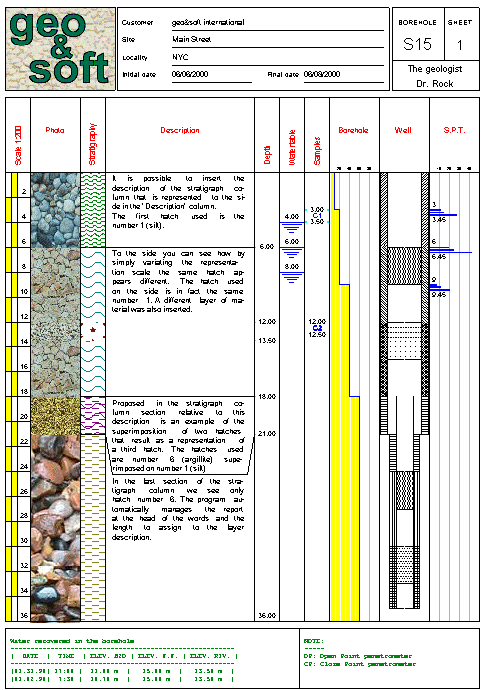
DBSOND is a program for the archiving and graphic restitution of boreholes and geological profiles.The main features are the large amount of information that can be archived and the possibility of personalising the program.The program offers more tha...