Import all your monitoring data into one system! Join the growing group of professionals around the globe who use VDV for all their long-term data monitoring. The keywords are: Powerful, easy to use, flexible, rock solid and reasonable ownership c...
PLog utilizes digital technology to the fullest extent in order to provide an efficient, consistent and reliable field data collection system. Specifically, PLog facilitates recording subsurface exploration data using customized, form-based software...
Process big data with ease View, QA/QC, transform, and analyse all raw data – geology, geochemistry, and geophysics – with powerful 2D and 3D modelling capabilities. &nbs...
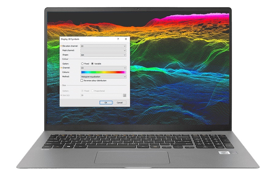
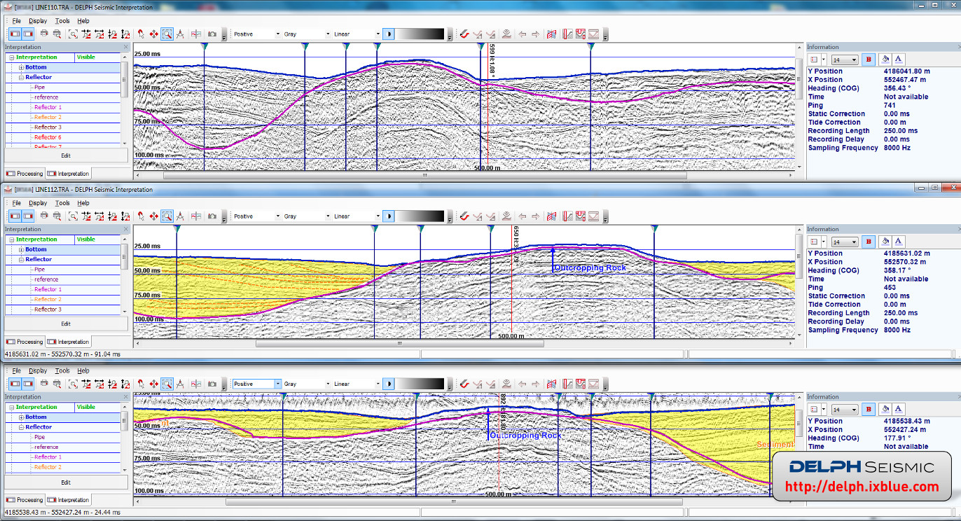
DELPH Seismic is the most advanced and complete acquisition, processing and interpretation software package in the industry. It provides geologists and geophysicists with an easy access to ALL data collected from shallow seismic systems and sub-botto...
Pitram is a leading mine control and management reporting solution that records, manages and processes mine site data in real-time. As a scalable solution, it is suitable for underground and open-pit mine construction, development and production. P...
SAASuite is a universal interface for Measurand's common SAA applications. Use it to keep up to date on software, manuals, and calibration files. SAASuite enables you to have access to: many SAA applications (free or not) Man...
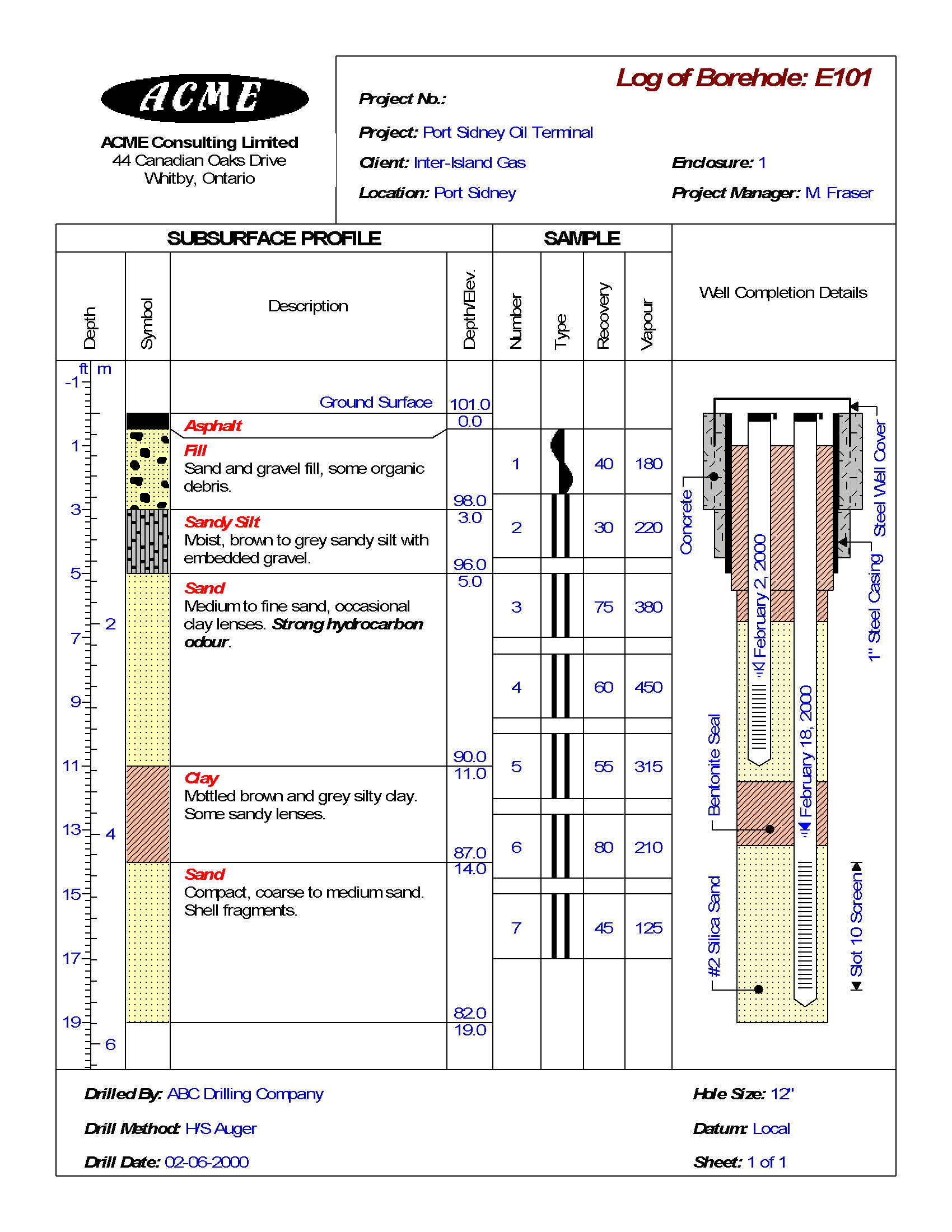
Logs can include virtually any type of subsurface – environmental, geophysical, petroleum, mining, and more. Using gINT logs, you can report and manage bore holes and well log data. Quickly enter or import data Print or export log...
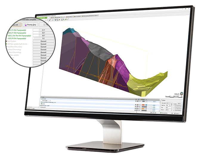
Save time for analysisChange how you look at and work with data using streamlined workflows. Generate cross sections rapidly and use tools that integrate your models with engineering designs.Increase the productivity of your 3D subsurface modelling w...
EDMS is used to improve and standardize environmental data collection, management, and reporting in an efficient and cost-effective manner. This is accomplished by implementing a documented, auditable process for the collection, storage, and reportin...
The WinLoG extension module of GaeaSynergy can be used to quickly and easily create, edit and print boring logs, borehole logs and well logs for a variety of industries. WinLoG is used by more than 3000 firms in more than 120 countries worldwide. Bor...
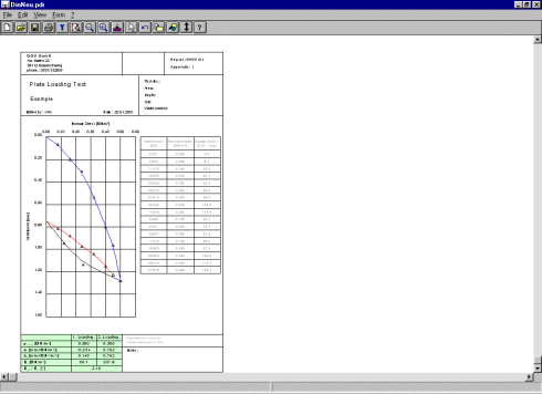
The program GGU-PLATELOAD enables the analysis and presentation of plate loading tests according to DIN 18134, DIN 18134:2010-04 (Draft) or Austrian Standard B 4417.
The SAAXYZ is a simple microprocessor interface to Measurand’s ShapeAccelArray (SAA) devices. It allows the user to get Cartesian XYZ position data directly out of the SAA. Visit Measurand's FTP site to access SAAXYZ's Basi...
PLAXIS Designer is a 3D conceptual model builder used to significantly reduce model creation times by visualizing, optimizing, and merging engineered earth structures, staged construction and excavation, topology, borehole, piezometer, and field inst...
After searching globally for a software solution, a client approached Mezintel to develop a solution for its concrete and soils testing lab, which was struggling to manage enormous amounts of paperwork. After 5 years of extensive development, BreakTe...
Our intuitive cloud-based borehole logging software removes a well know bottleneck within the Geotechnical Investigation process by generating finished graphical logs, on site, and in seconds. This means no data entry time back in the...