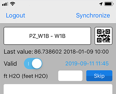
MLField® is a mobile application that is designed to bridge the gap between data collection and observations in the field, and the hosted project database. MLField® allows for identifying instruments in the field using a Quick Response (QR) code scan...
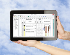
WinLoG RT can be used to create boring and well logs and manage boring and well data. The program can be used on tablets, laptops and desktops that have the Windows operating system. The user interface has been specifically designed to make data coll...
Clisp Studio csUnsat comes with the easiest test creation and setup of any Geotechnical Unsaturated Triaxial software package available today. Choose the test type you require, name the test and proceed through the steps of the wizard, initially sett...
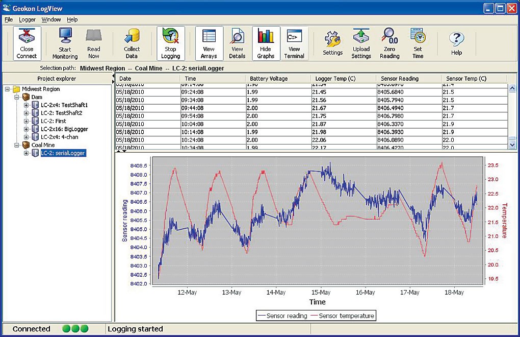
LogView Software simplifies the task of configuration, communication, monitoring, data collection and data reduction using the Geokon Model 8001 (LC-1) and Model 8002 (LC-2) series Dataloggers. The software is an easy to use, menu-based application,...
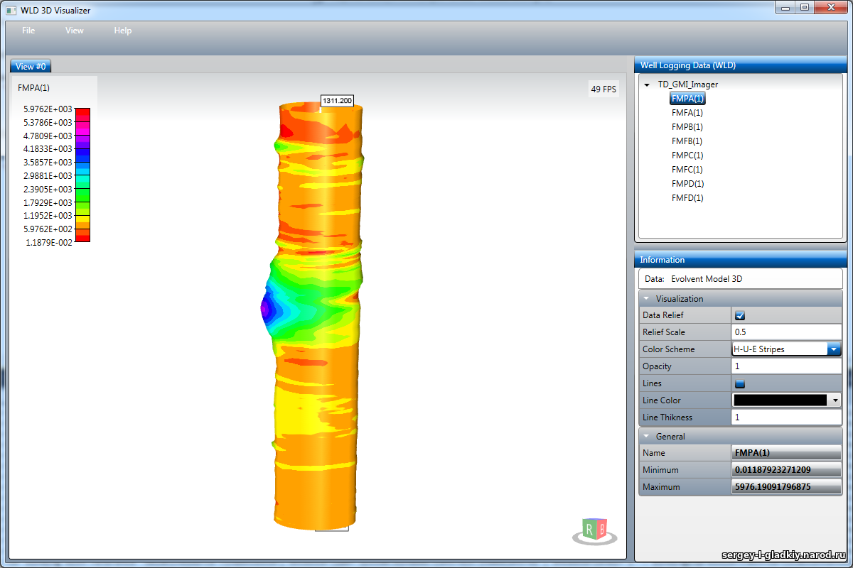
WLD 3D Visualizer (Well Logging Data 3D Visualizer) is a simple application for visualizing well logging data as 3-dimensional images. The 3D representation allows truly imaging of some borehole parameters. The program allows 3D visualization of curv...
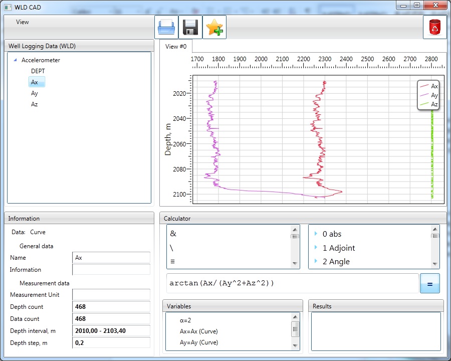
WLD CAD – is software for well logging data processing. The program is based on the ANALYTICS technology and allows calculating result data by any (nonstandard) formula. It works like ‘analytical calculator’ but input data is not real numbers, it is...
VIEWLOG provides a truly integrated borehole data management, visualization and interpretation system. By coupling a powerful borehole data editor with GIS-style mapping and cross-section tools, VIEWLOG offers unrivalled levels of visual interpretati...
GeoAxiom Vista is a specialist Geotechnical software which provides data handling, storage, visualisation, alarms, reporting and web based access from any size of automatic data acquisition system.For the visualisation and presentation of data from:
CVSoil is a complete and innovative tool for the determination of geotechnical characteristic parameters according to a probabilistic approach, considering the statistical quantities obtained from a suitable sample of tests.
Like most good ideas, EasyLog, Borehole Log Software, was conceived as a result of personal need. Because of the generalist nature of our professional careers, we wanted a logging program that fulfilled the following functions:Versatility: This progr...
The GGU-STRATIG programme allows the presentation of bore profiles and dynamic penetration tests according to German Standard DIN 4023. Presentation of drilled profiles (bores etc.), dynamic penetration tests, well casings, multiple gauges, pressure...
Enviro Data is a program for storing and displaying environmental quality data. This powerful and intuitive software uses Microsoft Access for the user interface and Access, SQLServer or Oracle as a back-end database. Enviro Data allows users to impo...
The next level of collaboration Central gives multidisciplinary teams a space to collaborate in the cloud. Whether you’re a geologist, geophysicist, engineer, manager, or stakeholder – everyone can keep abreast of project changes as th...