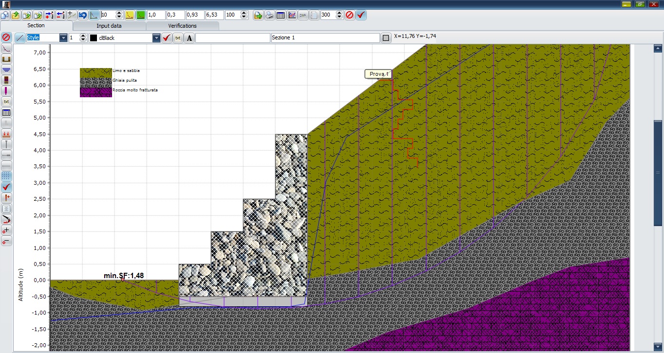
Earth pressures (by deterministic, probabilistic and fuzzy method approaches): Rankine; Muller-Breslau Mononobe & Okabe Caquot-Kerisel Trial wedge Internal stability (both seismic and static condition) : Forward sliding Overturning Bear...
Limit equilibrium methods : Fellenius; Bishop; Janbu; Spencer; G.L.E.; Sarma. Seismic analysis: Pseudostatic method ; Simplified dynamic method by empirical formulas; Simplified dynamic method by Newmark. Soil slope improvement tecni...
Tools that allow geologists to access and view drillhole data, define geological zones, accurately model orebodies and deposits, and more.Maptek VulcanVulcan Geology BundlesVulcan ExplorerVulcan Explorer provides an interactive 3D visualisation and m...
The Earthworks module is designed for modelling structures, such as foundation pits, roads, railways, quarries, slopes, and others. It also provides calculation of earthwork or terrain movement volumes. Cross sections, which can be exported into othe...
Generate inversions in minutes, not days Faster, Cloud-based geophysical inversion modelling gives you more time for interpretation and allows you to work on other tasks while your model processes remotely. Cloud computing is available on-deman...
Vulcan GeoModeller is ideal for creating geological, structural and grade/quality models for stratigraphic and non-stratigraphic applications. It can be used to perform face mapping in the field, geological modelling or to calculate preliminary resou...
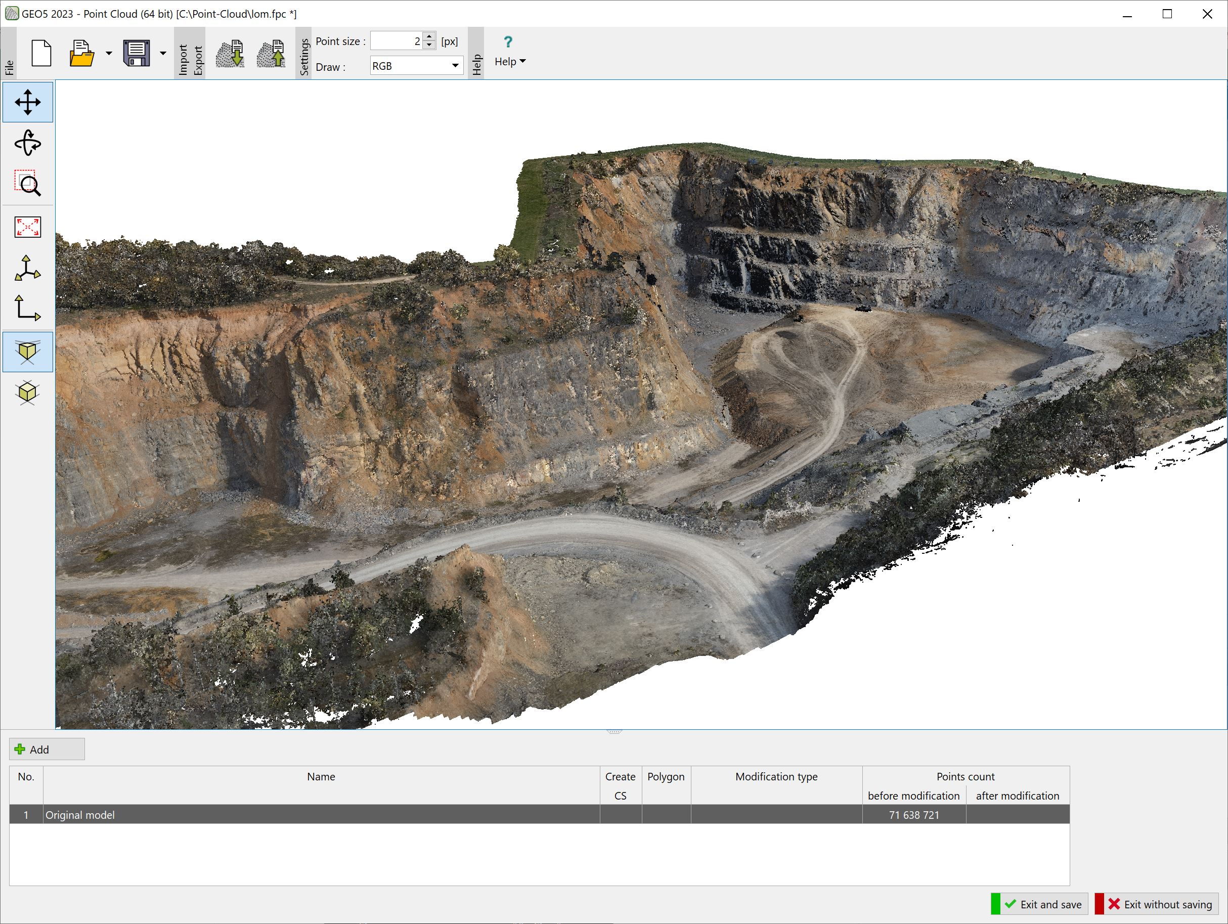
The program allows fast processing of point clouds (up to 100 million points) and export of resulting points into the program or external files.Main features: Data import in LAS, LAZ, E57 formats Simple and fast reduction of point cloud size Ability...