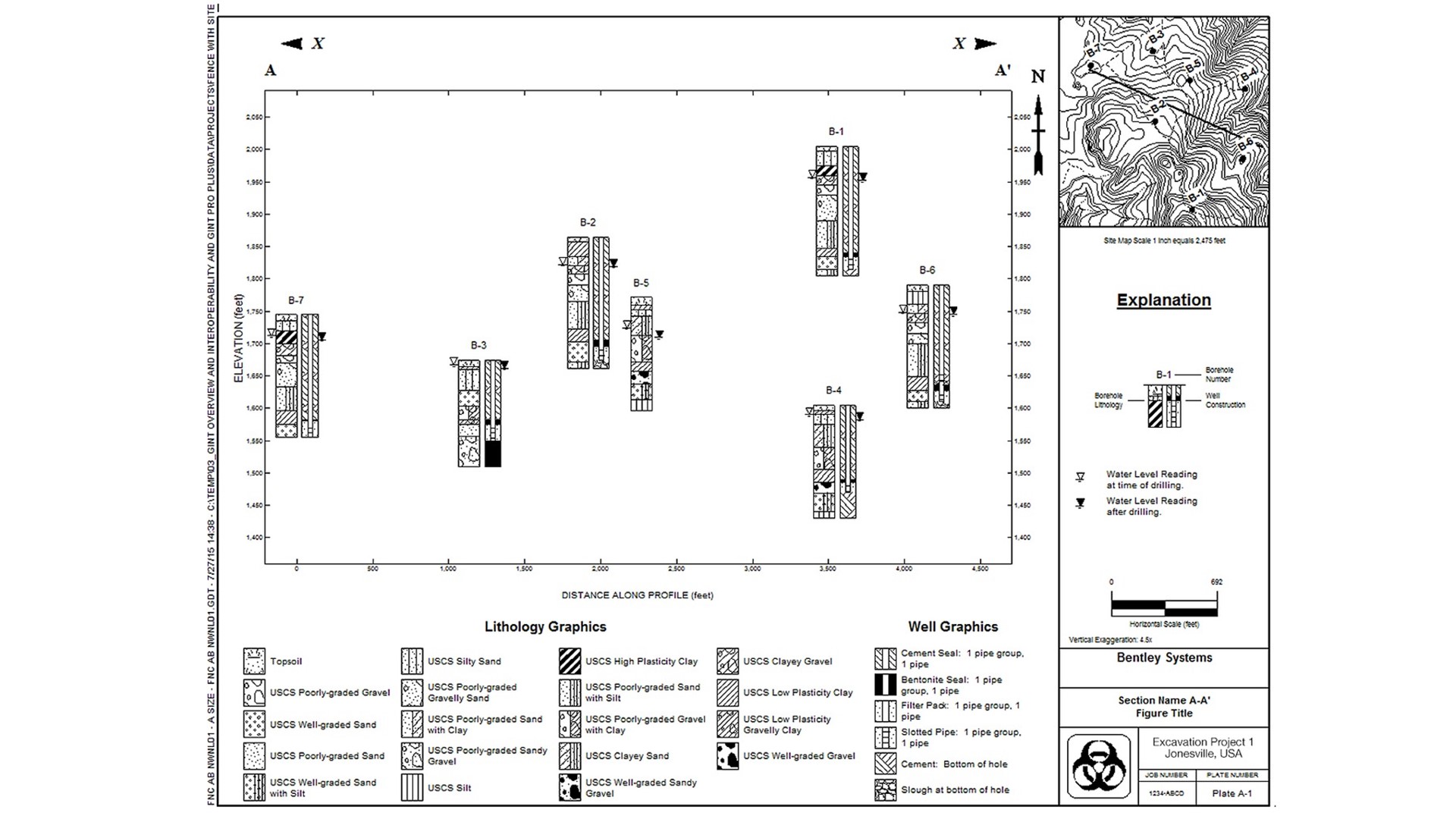
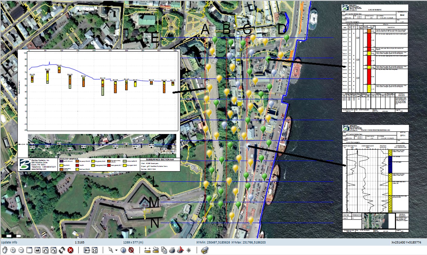
gINT fence diagrams present data for multiple boreholes on a single report. Any information that can be shown on a borehole log can be displayed on a fence diagram: water levels, well information, lab data, and more. gINT fences can also display site maps, surfaces, alignments, deviated boreholes, and “drapes” with graphics that depict features in elevation along an alignment on a 2D fence report. gINT performs the appropriate projection calculations for accurate display. Fence drapes can be used to display interpreted layered geometry, seismic tests results (for example, shear wave velocities), and existing features along an alignment (rivers, bridges, buildings, roads, and more).
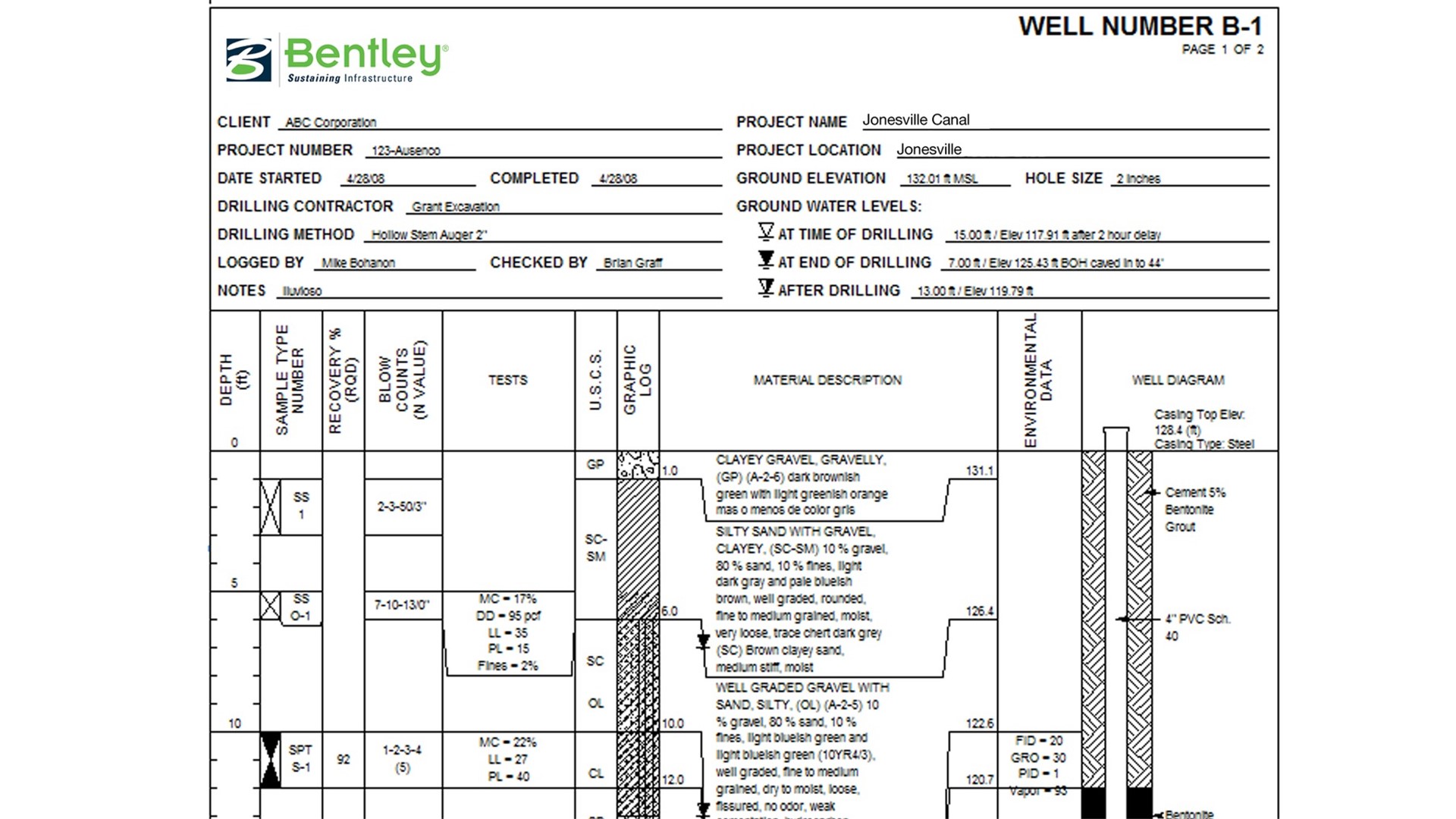
gINT’s “smart” reports allow multiple report variants to be combined, so that only one report is needed to handle diverse data conditions, simplifying reporting maintenance and ensuring reporting consistency. For example, log reports can have columns for well or water level data that only display when that data is available. Environmental reports can present data using different colors depending on such values as not tested, passed, failed, and more. Advanced report design capabilities such as conditional formatting, data manipulation, and decision making save time, and help ensure consistent, standardized reports.
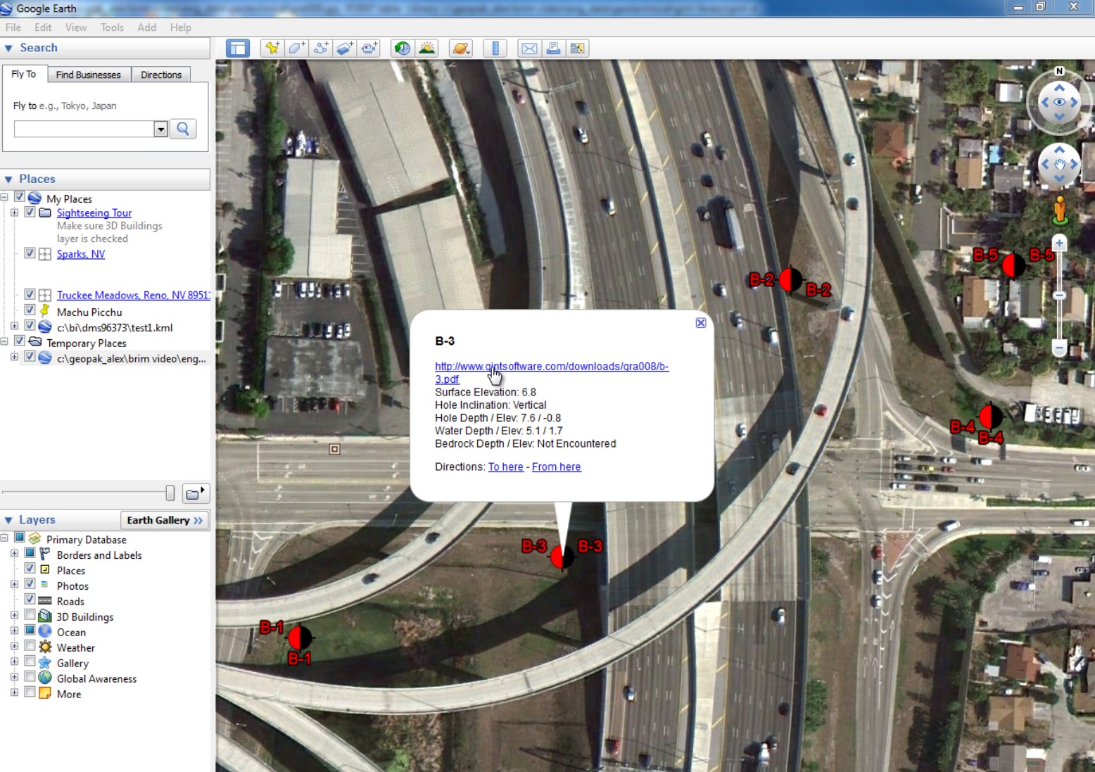
gINT allows users to view subsurface data directly from ArcGIS providing easy access to logs, lab data, reports, and more. The gINT for ArcGIS extension allows users to add the dimension of subsurface data to ArcGIS. Users can then generate gINT reports and query subsurface data direct from ArcMap.
gINT supports the data interchange formats from the U.K.’s Association of Geotechnical and Geoenvironmental Specialists (AGS). To make working with AGS data easier, gINT provides a starting database and reports for AGS data; however, gINT’s flexibility allows users to modify their database while allowing full AGS compatibility via correspondence files. Users can import, export, and validate AGS data, as well as edit AGS data directly in Microsoft Excel. gINT AGS validation goes beyond simply detecting file errors. gINT finds conditions that could compromise data quality as well as unnecessary, redundant, or missing non-critical, descriptive data. Users can easily generate data statistics for their AGS files such as the number of records in each file, hole counts by type, total drilling length, and sample type.
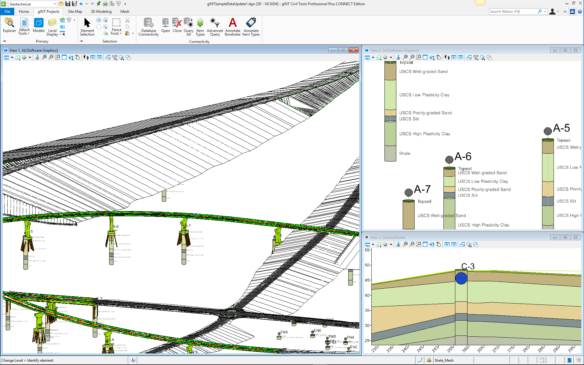
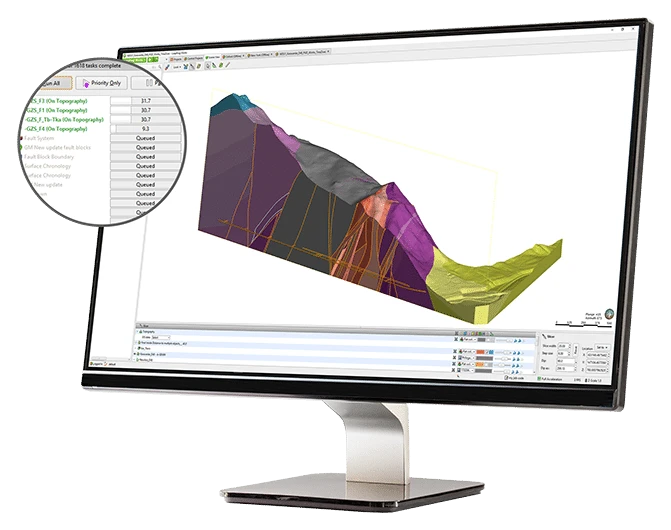
gINT Professional users have access to gINT Civil Tools, which provides capabilities for modeling and 3D analysis. Lithology contacts and water table surfaces can be created and modified. Boreholes and subsurface observations can be displayed using different formats to enhance analysis.
Because everyone has different needs and requirements, gINT provides multiple applications.