gINT Professional Plus builds on the reporting and data management capabilities of gINT Professional, adding Microsoft SQL Server support for efficient, centralized data management and powerful multi-project reporting.
gINT Professional Plus enables users to:
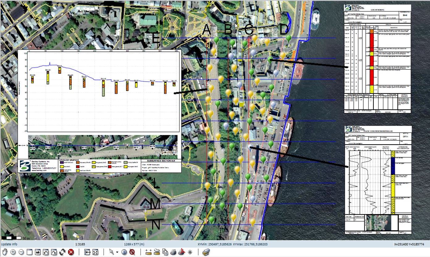
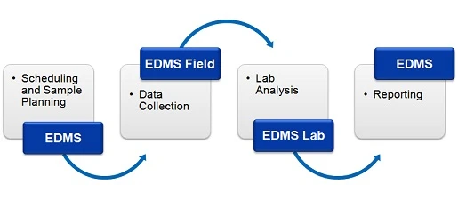
With gINT Professional and gINT Professional Plus users can quickly integrate lab testing results with other subsurface data. From raw lab data, gINT can perform calculations for any of 13 different lab tests provided with the gINT installation. Once raw lab data is entered into gINT, the resulting calculations can be used on any type of report: logs, fences, tables, and more. gINT California Bearing Ratio (CBR) and Concrete Testing are free applications available for download from the Bentley Communities website.
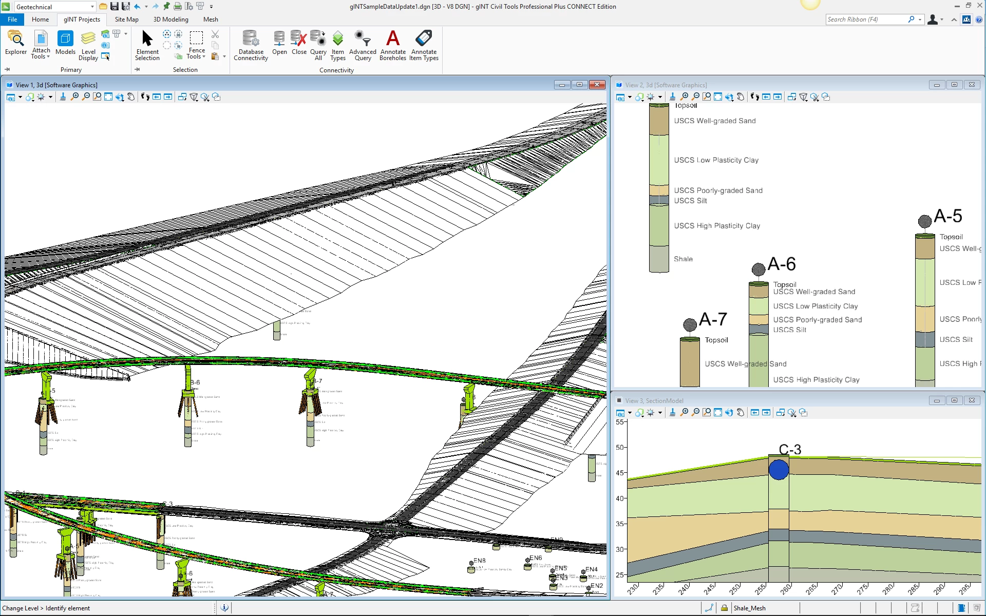
gINT Civil Tools Professional and gINT Civil Tools Professional Plus allow users to view subsurface data directly from their gINT project, in the same environment as MicroStation CONNECT Edition. Connected to a gINT database (.gpj or SQL Server), users can query the information needed and use different mapping methods to display data with different formats: depth - bottom; depth - length; and depth only. For example, lithology is displayed using Depth – Bottom or Depth – Length data while a water level uses Depth Only. The objects created in the 3D model will contain information related to the mapping of its table.
Users have the choice to import specific, chosen information associated with an imported table depth and/or bottom/length and identifier data into the model. This means users can import all the data in a table associated with the table, such as blow counts, lithology description, well construction remarks, lab data, and more. Three-dimensional annotation for boreholes is also available, and is independent from the view to have a comprehensive model.
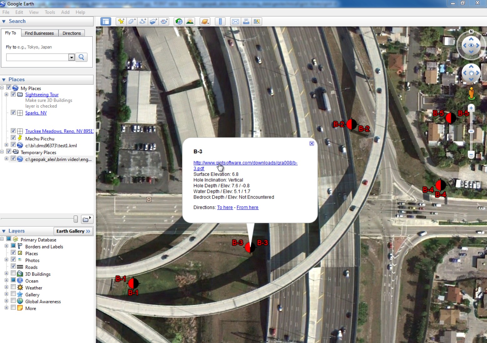
gINT Civil Tools provides an environment where all the required information to start a new geotechnical project can be gathered and reviewed to create a site investigation plan. Working in gINT Civil Tools Professional or gINT Civil Tools Professional Plus, the user has access to geological maps, images directly from Google Earth, road plans, preliminary drawings, and more. Plans and maps can be overlaid to better understand the local environment and help plan the site investigation. To complete a site investigation plan, new points (borehole locations) can be created directly on the plan and stored in the connected gINT project to be used downstream in the project as data is collected and entered in to gINT.
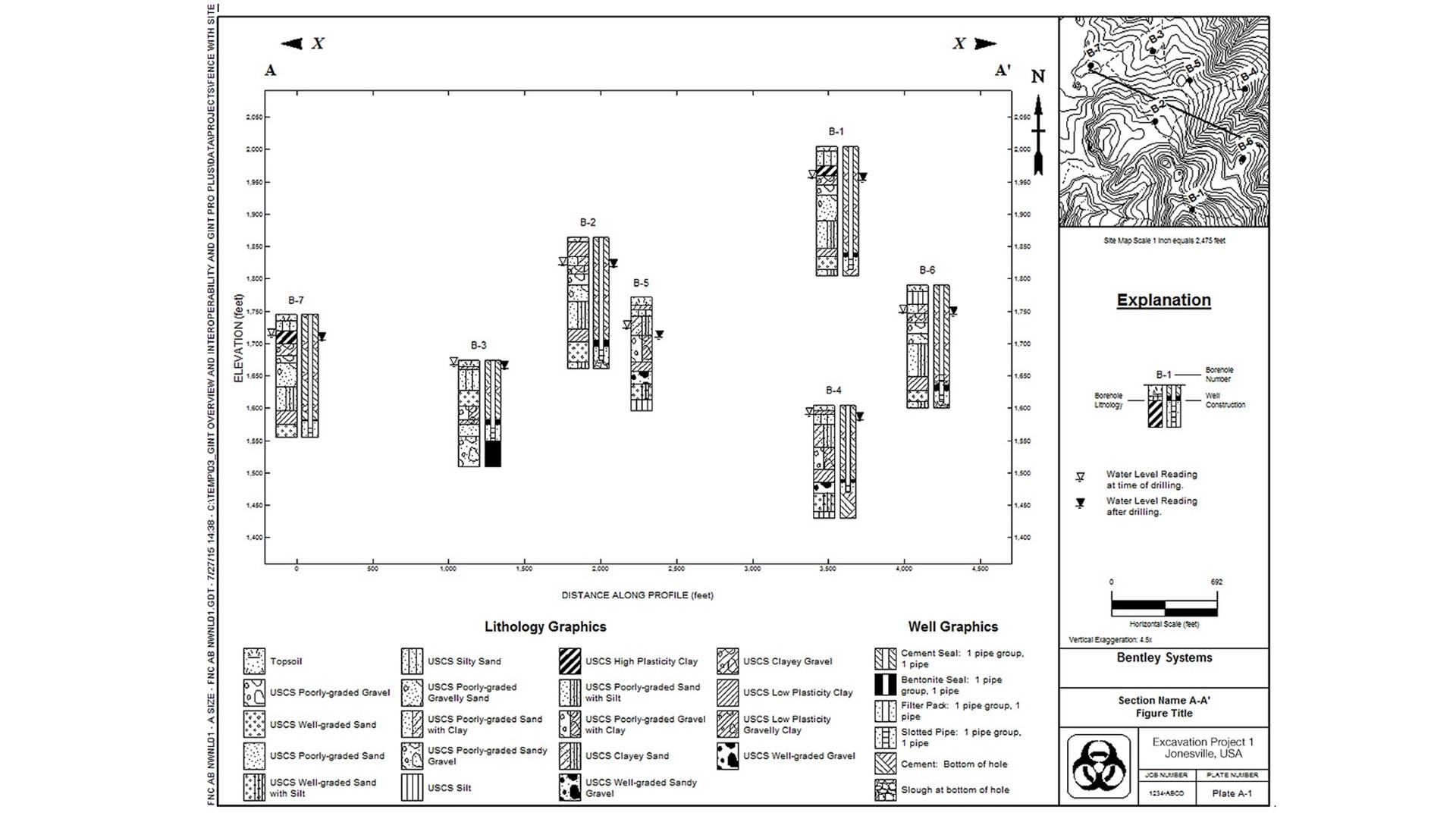
gINT Civil Tools Professional and gINT Civil Tools Professional Plus have the capability to create surfaces for different aspect of the stored data. For example, specialized functionality gives the user the ability to create a surface representing the actual ground based on boreholes’ collars. Surfaces can also be created using lithology and other subsurface observations such as water level. When a lithology is used to generate a surface, the user has the choice to create it from the top or the bottom of the lithology. These surfaces can be smoothed using a simple kriging method to create a realistic model. Visualization of lithology contacts in a 3D model help the geotechnical team plan and understand the complexity of the site earlier in the project.
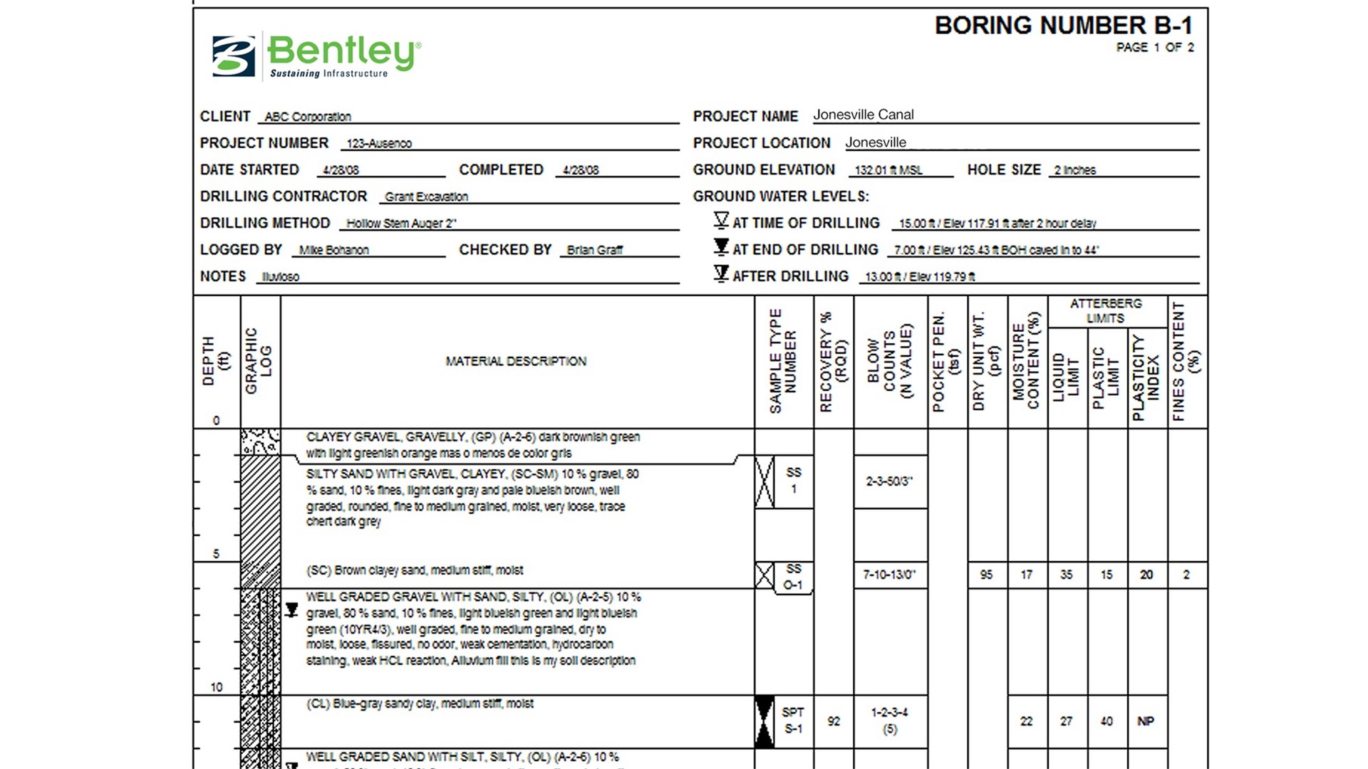
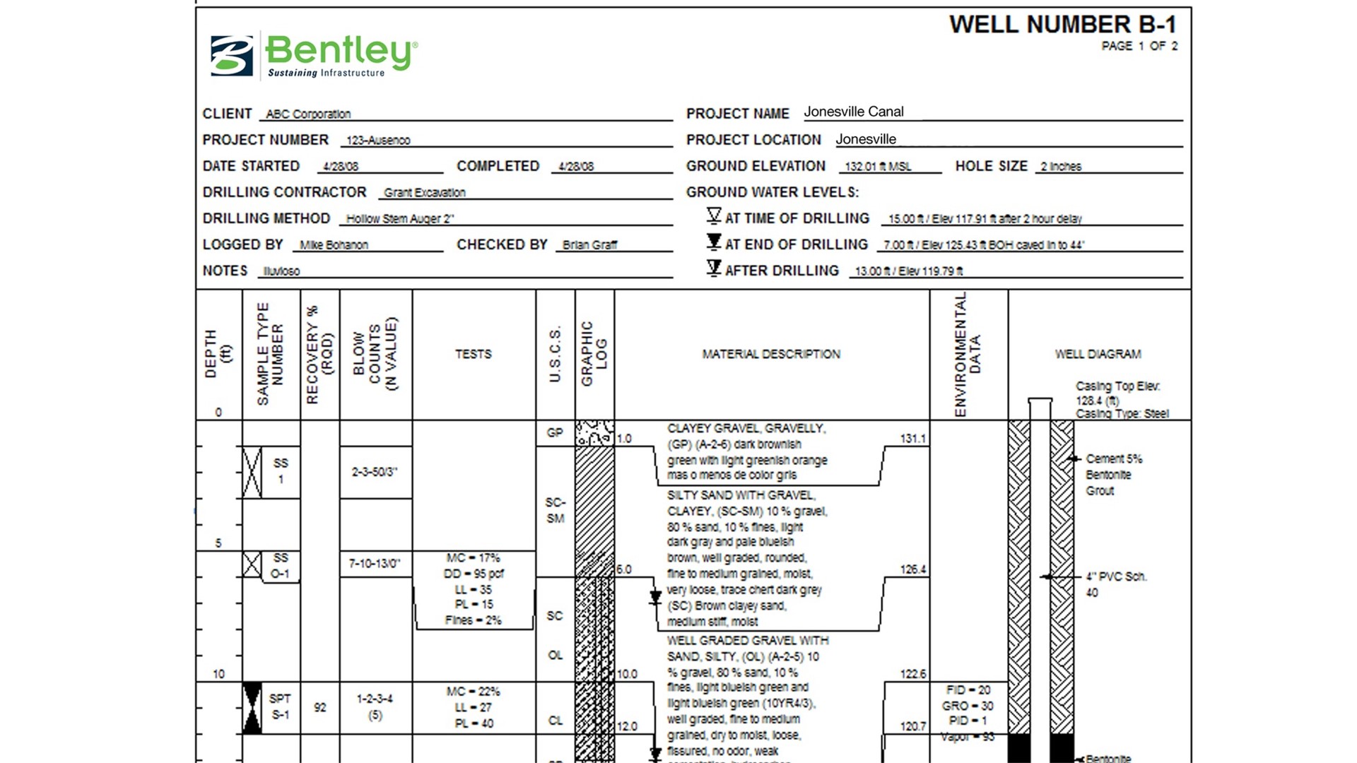
The industry leader for over 25 years, gINT software is designed by experienced engineers who fully understand the standards and requirements that facilitate high-quality geotechnical and geoenvironmental data management and reporting. gINT delivers a full spectrum of data with flexible options to define and customize reports to best suit user preferences.
The CONNECT Edition provides a common environment for comprehensive project delivery and connects users, projects, and your enterprise. With gINT CONNECT Edition, you now have a personal portal to access learning, communities, and project information. You can also share personal files including i-models and PDFs direct from your desktop with other users. With the new project portal, your project teams can review project details and status, and gain visibility into project performance. With the CONNECT Edition, your project team may also wish to take advantage of the new ProjectWise Connection Services including Project Performance Dashboards, Issues Resolution, and Scenario Services.
Because everyone has different needs and requirements, gINT provides multiple applications.