TerraBase features a seamless interface with ArcView GIS. Data that would normally be a simple spreadsheet or report is automatically displayed on a map to show features such as 2D and 3D contours, subsurface detail and a whole lot more.
TerraBase ArcView Extension Features
Automatic import of chemical, geological and other environmental data
Two and three dimensional spatial analyses of chemical data and geotechnical data
Automatic generation of potentiometric contours
Automatic generation of chemical concentration contours
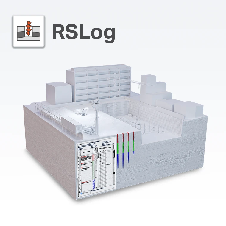
Automatic generation of soil boring logs
Automatic generation of monitoring well cross section diagrams
Automatic generation of hydrographs with corresponding chemical concentration data
Seamless integration with ArcView 3.2a and 3D Analyst
Seamless output to Microsoft products (Excel, Word, Access)
Generation of “chemicals of concern” list
Manages analytical information from any media/matrix
Powerful built-in reporting features and report design capabilities Crystal Reports Crosstab
Time vs. Concentration plots
Supports up to four levels of data quality for chemical data
Query/reporting capabilities across multiple sites using the Enterprise Query Application
Scalable versions from Workstation to Enterprise, and Web-Enabled
Scalable versions from Workstation to Enterprise, and Web-Enabled
Customizable reports using Seagate’s Crystal reports
Runs on Windows 98, 98SE, NT, 2000 and XP operating systems
Enterprise Editions are available for Oracle 8.x and Microsoft SQL Server 7.x & 2000
Seamless integration with ArcView GIS, ArcView 3D Analyst
Data format checkers and translators available
Sample Info tool lets user review sample history for each individual mapped sample location
Timeline tool lets user review sampling history at mapped locations; user can add customized events
Document Manager links mapped site to other files and documents
Layout Tool creates quick map for printing
Overview window shows entire site with “you are here” graphic
Analytical
Analytical Query tool sends data to map, Excel, Crystal Reports report, Crystal Reports crosstab
Analytical Query supports summary queries (maximum, minimum, or average result) by matrix, location, or date
Analytical Query supports the filtering of results in TerraBase by project, site, sample location, matrix, media, fraction, analyte, date, result qualifier, concentration, sample type, analytical method, detection limit, and sample depth
Analytical Query supports unit conversion and selection of desired level of data quality associated with results
Geotechnical
Geotechnical Query sends groundwater data to map, Excel, Crystal Reports report, contouring, or 3D scene
Geotechnical Query sends lithology data to map, Excel, Crystal Reports report, or ESRI 3D scene
Geotechnical Query sends well construction data to map, Excel, Crystal Reports report, or 3D scene
Geotechnical Query supports filtering results by well type, well install date, well depth, soil type, well diameter, well status, site, and well name
Geotechnical Reports generates boring logs, cross section diagrams, or hydrographs (plots of multiple chemicals and groundwater against time, with option for free product thickness plot)
Soil Profiles shows lithology for selected wells, with user tools to create soil layers; final results can be printed or sent to layout for display
3D Analyst Extension
Site Wizard allows for adding and editing site information, customizing site base maps, and adding locations to TerraBase by clicking on the map
Supports analyte or groundwater contouring; contouring tool allows for adding or deleting data points, choosing method (inverse distance weighted, spline, universal kriging, or trend), creating surface or TIN for 3D display, labeling contours, and adding flow lines
Supports visualization of analytical or geotechnical query results in 3D scene, which can be rotated and flipped for full 360 degree views
Specifications
Licence:
Commercial
Provider:
TerraBase Inc.
Platforms:
Desktop - Windows 95/98, Desktop - Windows NT, Desktop - Windows 2000, Desktop - Windows XP
Tags
chemical datachemical of concernborehole loggingborehole logGeotechnical Datageotechnical reportGIS dataenvironmental datagroundwater datawell construction
DCOdes aims to provide accurate and up-to-date information on various software products for our visitors.
We value your contribution to the software industry and would be happy to help you claim your listing and ensure that your product
is accurately represented on our platform.
If you represent a software provider company, we will give you access to manage all your company's listings that exist in our database.
All you have to do is: create a free account, claim your software and wait for our approval.
DCOdes uses third party cookies to improve our website and your experience when using it.
To find out more about the cookies we use, consult our Privacy Policy.