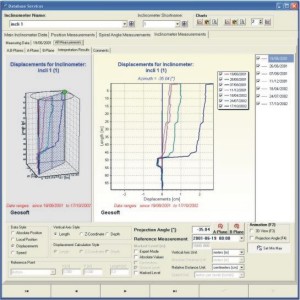
DigiPro2 software manages inclinometer data, generates plots and reports, and provides corrections for systematic errors. DigiPro2 replaces the original DigiPro and DMM, merging their functions into a single program that feels familiar, but is easie...
Overview QuikSlope is designed by experienced surveyors to provide reliable data processing, storage, analysis and reporting of monitoring/stability data. QuikSlope provides an affordable data management system for either a manual or fully automated...
Why use FlowWorks? FlowWorks is Flexible. Real-time, manual, historic, USGS, NOAA, wireless, satellite – it doesn’t matter where your data originates. You can connect it to FlowWorks. FlowWorks is Affordable. We provide a full-access data collect...
RST Inclinalysis™ Software is a powerful companion to the RST Digital Inclinometer System. It allows the user to quickly and efficiently reduce large volumes of inclinometer data into a variety of formats suitable for analysis and presentation.
Geoscope is the first open, modular system that can consolidate data from multiple sources, process it, and deliver it in a single, clear format via an intuitive interface. Dynamic data links can be set up between Geoscope and other global project s...
GTILT is designed to help you handle large and small volumes of slope inclinometer data with a minimum of effort. A wide range of inclinometer probes, readouts, and loggers is supported, so even if you use equipment from more than one manufacturer, G...
The INCLI-pro application allows the user to save the data resulting from inclinometric measurements and auxiliary measurements (location of the inclinometer, measurement of inclinometric column spiral angle as well as actual inclinometric measuremen...
GeoViewer is a data viewer that provides flexible console viewing of large data sets from ADAS (automatic data acquisition systems). The program runs on Windows®, with full functionality under Windows Server®. GeoViewer operates on a LabVIEW™ platfo...
SPIRAL CORRECTIONS GTILT PLUS includes a copy of the GSPIRAL utility, which handles data from an incremental spiral tool in the same way as GTILT handles inclinometer data. GSPIRAL calculates casing twist versus depth, and can write spiral data file...
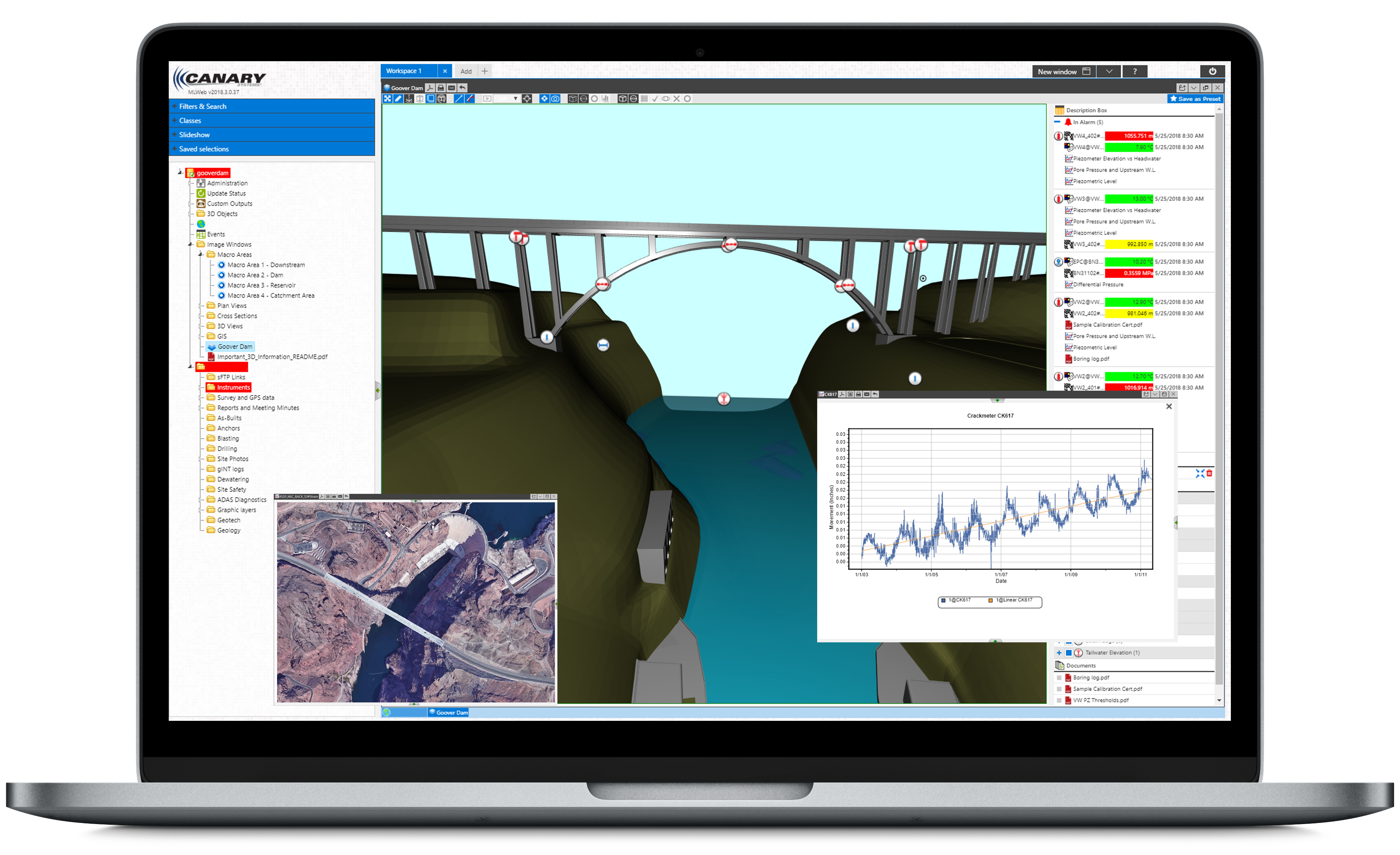
MLSuite is the most powerful integrated platform on the market for collecting, managing, processing, presenting and analyzing many types of monitoring data. Flexible calculation, notification, charting and reporting options help translate raw data i...
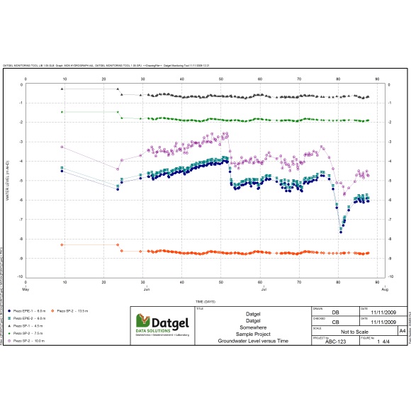
Datgel’s Monitoring Tool plugs into market leading gINT software to streamline the processing of monitoring data associated with geotechnical and geoenvironmental projects. It allows you to link your monitoring data with the rest of your subsurface...
The SCS (Syscom Cloud Software – scs.syscom-instruments.com) is a turnkey solution for the visualization, management and reporting of data coming from any MR3003 or ROCK instruments. It provides easy access from anywhere to the vibrat...
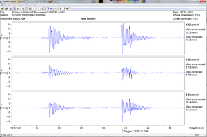
Main Features: Direct opening of the files Visualization of time history and FFT related to an event Visualization of background values Display of device status information Information saved in a report format, ready to be printed...
RSTAR Affinity integrates sensor data logging, capture, communication, and near real-time analysis into an end-to-end solution for the geotechnical industry. Data retrieval can be configured, and analysis can be performed from the comforts of an o...