The GEO5 Stratigraphy program is designed to process results from site investigation (boreholes, wells, CPTs, DPTs, SPTs, DMTs ...), generate 2D or 3D geological models and export cross sections and geological profiles into other GEO5 programs. The modules Logs and Cross Sections for professional site investigation reports are available for this program. The main features of GEO5 Stratigraphy program are:
- Assessment of site investigation results – boreholes, wells and field tests:
- CPT - Cone penetration test
- DPT - Dynamic penetration test
- SPT - Standard penetration test
- DMT - Dilatometer test
- PMT - Pressuremeter test
- Interpretation of field tests into geological profiles
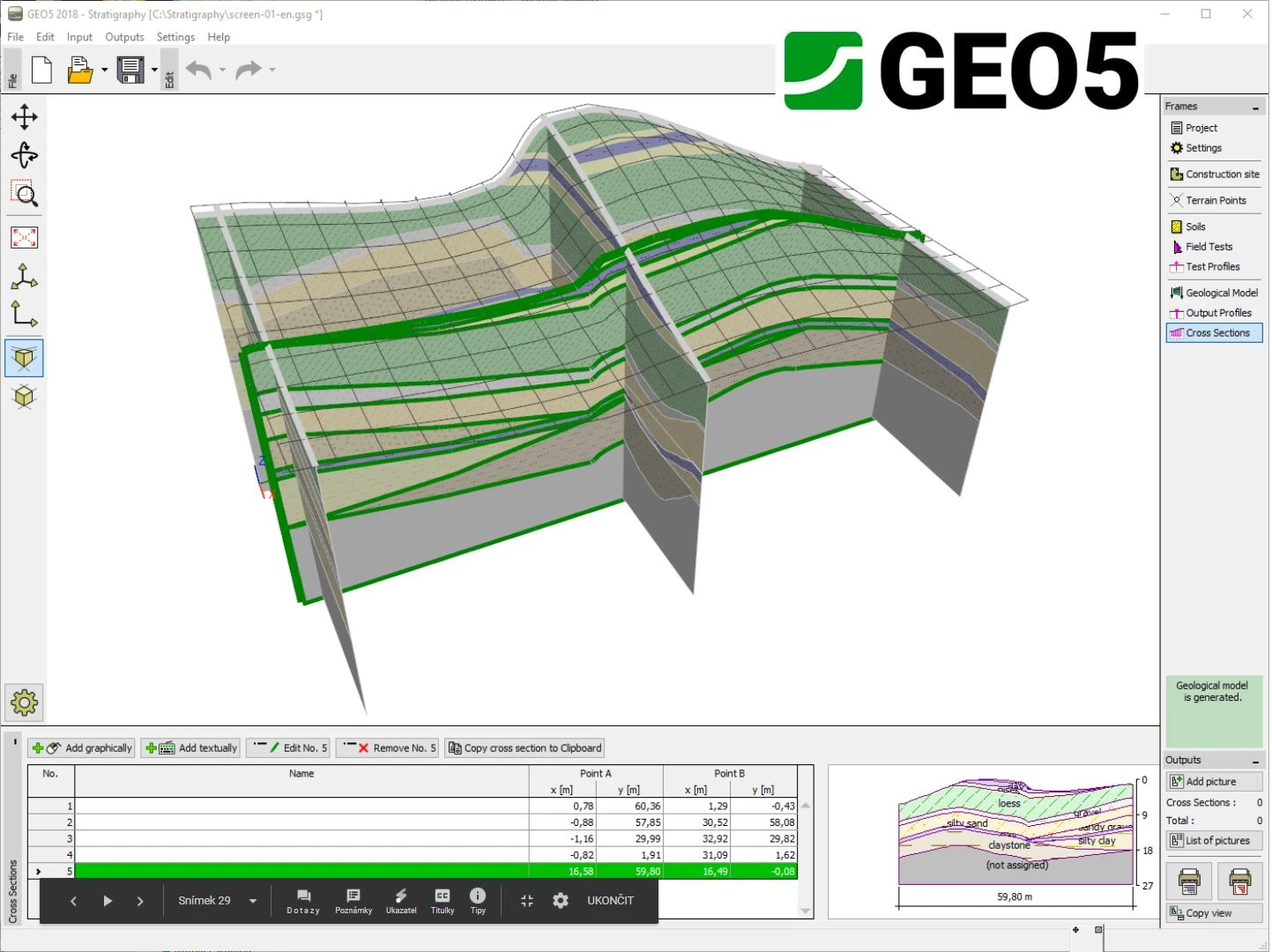
- Creation of 3D and 2D subsoil models from soil profiles
- Generation of very complex geological models (horizontal or inclined layers, faults, erosion, lenses, landslides)
- Optimization supporting very large models
- Input of GPS coordinates with a direct connection to Google Maps
- Import of field test formats including AGS, TXT, UNI, CPT, GEF… and more
- Export to both IFC and LandXML BIM formats
- Export to selected GEO5 programs and CAD programs
- Professional site investigation reports with the Stratigraphy - Logs module
- Creation of geological fences in the Stratigraphy - Cross Sections module