GEO5 is an intuitive software suite providing a solution for the majority of geological & geotechnical tasks. From geological site investigation, subbase model creation up to a wide range of analyses such as slope stability, deep excavation, and...
LOGitEASY's web-based soil logging and boring log software (LOGitEASY eForm) is usable both in the field and in the office for transferring field notes. Once the data is entered into the software, logs can be produced in a variety of templates, incl...
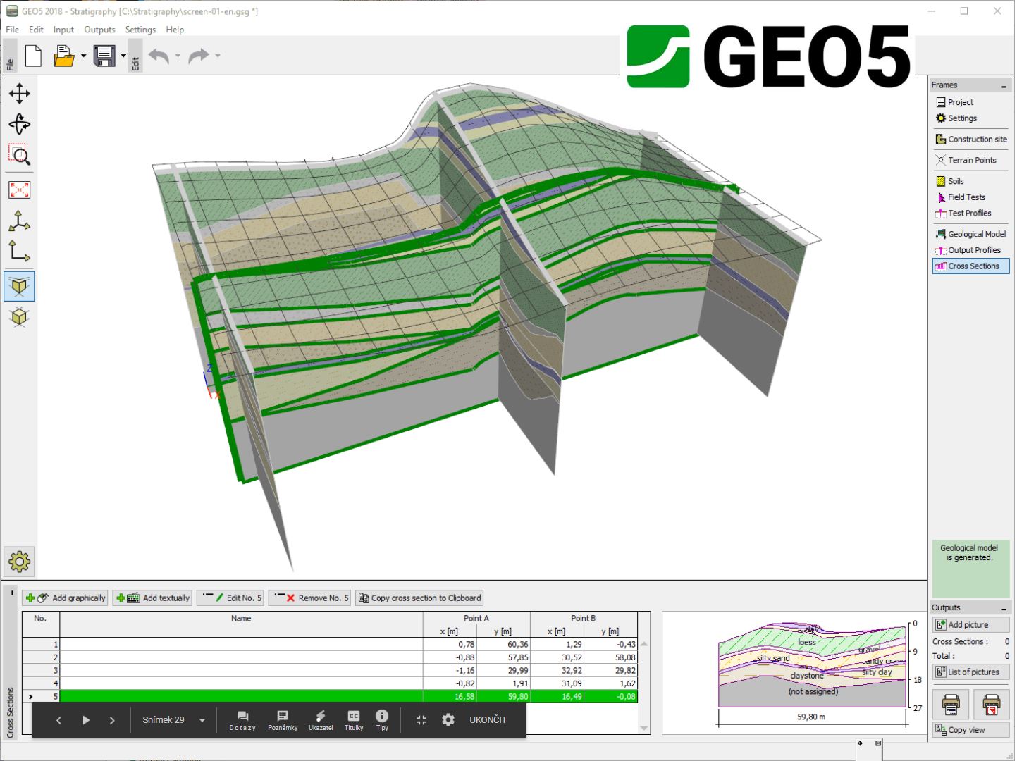
The Stratigraphy - Cross Sections module is designed for easy creation of geological cross-sections (including lenses, faults). It provides scaled outputs of the cross-section with field tests and soil profiles. No CAD program is needed. For geologi...
Mobile application GEO5 Data Collector (for Android and iOS in May/23) is used for data collection in the field or laboratory and works with mobile phones and tablets. The mobile application and the GEO5 Stratigraphy program can then exchange these d...
The Stratigraphy - Logs module is used for geological data reporting from site investigation (boreholes, wells, SPT, CPT, DMT and more). It provides a comprehensive database of pre-defined templates and the ability to create user-defined templates a...
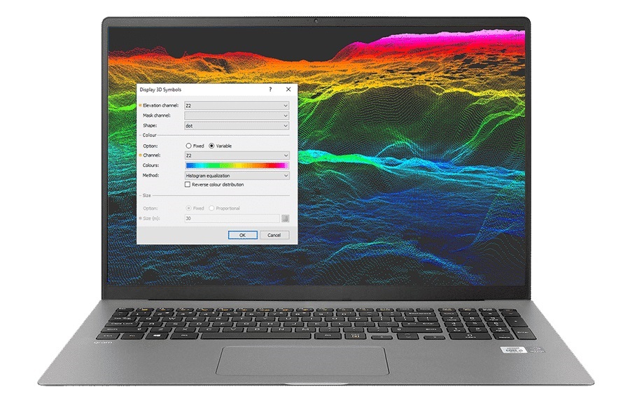
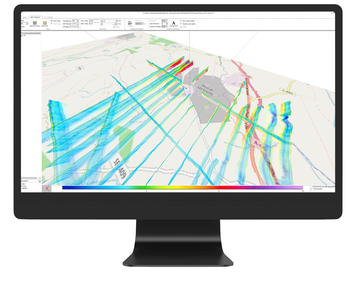
Process big data with ease View, QA/QC, transform, and analyse all raw data – geology, geochemistry, and geophysics – with powerful 2D and 3D modelling capabilities. &nbs...
PROGRAM GEO'S ANNUAL LICENSE. What’s the Program Geo's annual license? It is a license which allows the Customer to use for a whole year, since its activation and without limits, our software package, including all the programs li...
A managed code .NET GIS SDK for developing professional web GIS applications for hosting on Windows, Linux, and macOS servers (including Docker). The SDK is designed and compiled natively for ASP.NET Core and Web Forms, with support for MVC and Razo...
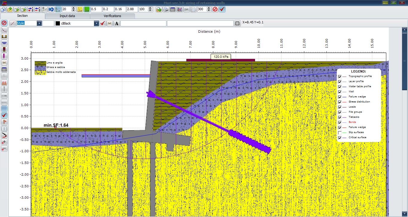
Earth pressures (by deterministic, probabilistic and fuzzy method approaches): Rankine; Muller-Breslau Mononobe & Okabe Caquot-Kerisel Trial wedge Internal stability (both seismic and static condition) : Forward sliding Overturning...
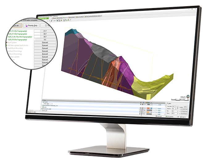
Save time for analysisChange how you look at and work with data using streamlined workflows. Generate cross sections rapidly and use tools that integrate your models with engineering designs.Increase the productivity of your 3D subsurface modelling w...
A professional grade GIS software development kit (SDK) used by customers in a wide range of industries to develop custom GIS applications or add geospatial functionality to existing products. SDK editions are compiled natively for the Delphi/C++Bui...
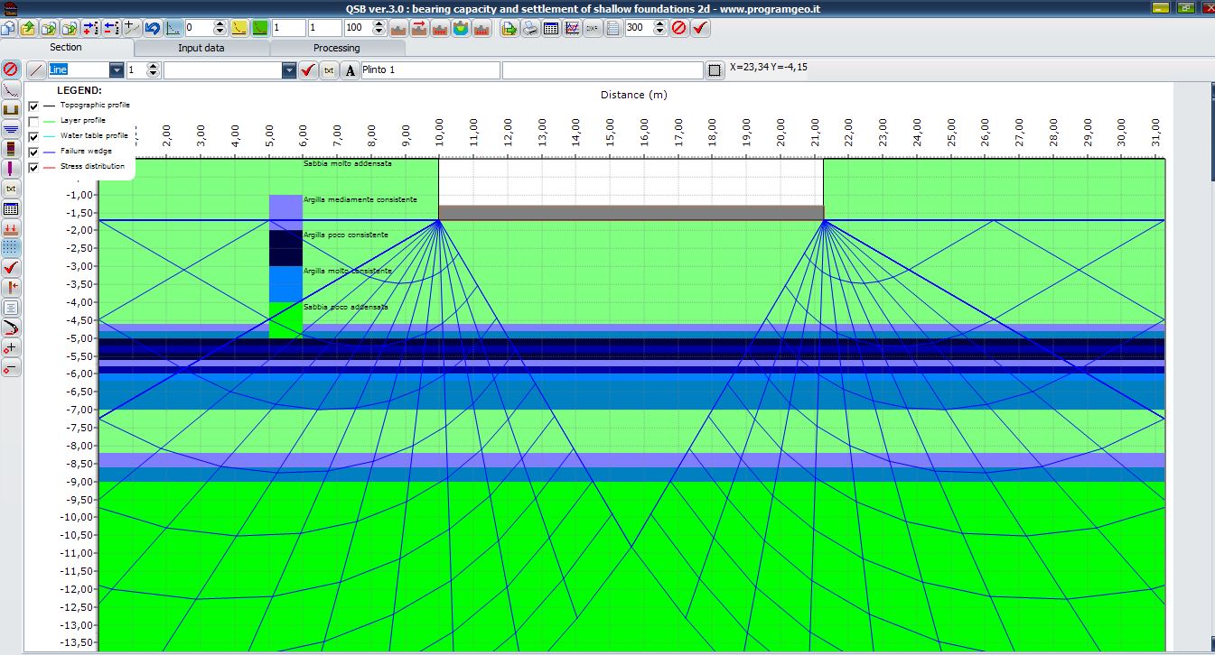
QSB2d: bearing capacity and settlements of shallow foundations Bearing capacity (both static and seismic conditions) : Terzaghi; Meyerhof; Vesic; Brinch Hansen; Modified Brinch Hansen; Froelich. Sliding resistance (both static and seismic...
Process and invert your data with speed Experience a simple workflow from data import to inversion and visualisation, while still having access to full control over inversion parameters for those more experienced. The software is highly optimiz...
Stereographic projection of rock discontinuities: Schmidt (automatic clustering and assesing of eigenvalues and eigenvectors); Wulff. Analysis of spacing and frequency of rock discontinuities. Assessment of the roughness of rock discontinui...
The GEO5 Stratigraphy program is designed to process results from site investigation (boreholes, wells, CPTs, DPTs, SPTs, DMTs ...), generate 2D or 3D geological models and export cross sections and geological profiles into other GEO5 programs. The...