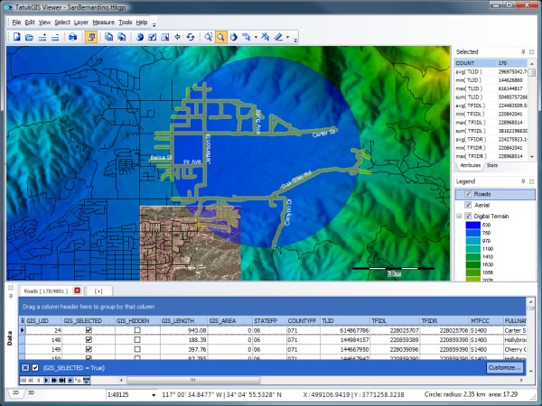
General-purpose desktop GIS viewer of map projects and geospatial data, natively supporting a great number of data formats and 5,000+ predefined coordinate systems with on-the-fly layer reprojection. Comprehensive visual layer properties, legend, scale, and other controls enable full customization of the appearance of each layer and building sophisticated multi-layer map projects.
A dedicated Data Panel displays layer attribute information in grid form with powerful query tools that work interactively with the map.
Product can be used to distribute, without software licensing cost, custom GIS map projects and data to users for easy access. The TatukGIS Viewer is licensed as a free product for personal and commercial use.