General-purpose desktop GIS software for geospatial data creation, editing, mapping, and analysis, providing the features and tools most GIS users require. Specialized features or customizations can be added as scripted plug-ins. A powerful built-in scripting engine exposes, within the Editor, the comprehensive TatukGIS object-oriented API with hundreds of classes and thousands of documented methods and properties designed for custom GIS development.
The Editor natively reads 75+ geospatial industry data formats and writes data to 35+ vector, image, grid, and database layer formats, including advanced spatial databases such as PostGIS, Oracle Spatial, MSSQL Spatial and others.
A dedicated Data Panel displays layer attribute information in grid form with editing and powerful query tools that work interactively with the map.
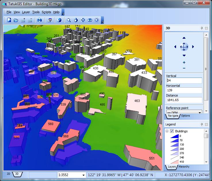
Other features include comprehensive visual properties, legend, scale and other controls, editing tools for map geometry and attributes, 5,000+ predefined coordinate systems, on-the-fly reprojection, GPS tracking, database joining, layer rectification, topological operations, data classification methods, layer statistics, vector-to-grid interpolation algorithms, raster algebra, operation pipelining, dynamic shapes aggregation, viewshed & above-ground-level (AGL) visibility analysis, slope analysis, point cloud-to-grid conversion, 3D visualization, and much more.
Volume discounts are available for commercial customers with multiple users.