Since 1986, Hydrau-Tech, Inc. provides engineering community state-of-the-art software for sediment transport modeling, sediment data, bridge scour modeling, sediment transport computation, open channel hydraulics, environmental river mechanics, rive...
Carlson Takeoff is a cut/fill volumes and data prep (for layout or machine control) program that can estimate jobs using paper plan digitizing, PDFs, or electronic CAD files Key features include: Calculate site cut & fill and topsoilDifferen...
Our software SedTec is integrated in WinGeol so that the whole processes of data preparation and visualization / analysis can be done without complicated and error prone import / export operations. To compare simulation results with reality virtual w...
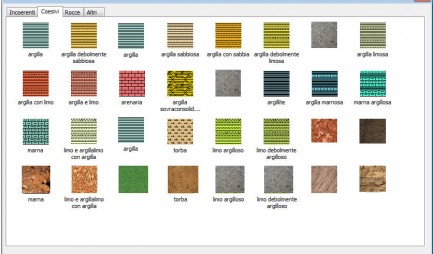
Library of lithological textures divided into categories: Noncohesive soils, Cohesive soils, Rocks and Other. Also includes Vector Textures and a Texture Editor that gives the possibility to add new soil textures or alter the existing ones. ...
ROTOMAP is a three-dimensional model that is used for rockfall analysis and the design of rockfall protective systems. This module belongs to the Isomap family: please check the ISOMAP page for a complete description of the main module features. ROTO...
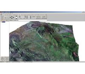
WinGeol is a software application for viewing, editing and analysis of location based data (GIS). WinGeol is available in a free version and non free versions with advanced analysis possibilities (for geological applications). It was developed from e...
I-Site Studio - Geotechnical ModuleThe I-Site Geotechnical module provides geologists and geotechnical engineers with powerful tools for analysing structures and undertaking kinematic analysis. Working directly on laser scan data ensures accurate and...